

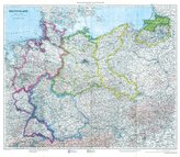
Historische Karte: Die BALKAN Halbinsel - um 1910 [gerollt]
![Historische Karte: Die BALKAN Halbinsel - um 1910 [gerollt]](https://img-cloud.ucebnice.cz/2577449-large/e8c9b320c96ec62a102f975b27b10afb/historische-karte-die-balkan-halbinsel-um-1910-gerollt.jpg "Historische Karte: Die BALKAN Halbinsel - um 1910 [gerollt]")
16
%
412 Kč 488 Kč
Sleva až 70% u třetiny knih
| Autor: | Handtke, Friedrich |
| Nakladatel: | Rockstuhl Verlag |
| ISBN: | 3959663390 |
| Rok vydání: | 2018 |
| Jazyk : | Němčina |
| Vazba: | Mapa |
Mohlo by se vám také líbit..
-
Güterkursbuch der Deutschen Reichsbah...
Rockstuhl, Harald
-

Die HENNE-KASERNE in Erfurt 1950-1990
Schreiber, Peter
-

Mein Kriegstagebuch als Kradschütze i...
Kästner, Herbert
-
Atlas Kreis Heiligenbeil - Regierungs...
Rockstuhl, Harald
-

Thüringer Sagenbuch 1
Bechstein, Ludwig
-

Fliegerhorst und Luft-Nachrichten-Sch...
Dittmann, Fred
-

Fotoalbum - Panzer-Werkstattkompanie ...
Rockstuhl, Harald
-

Lustige Feuerwehrgeschichten
Wucke, Bernd
-

Sagenbuch von Eisenach und der Wartburg
Bechstein, Ludwig
-
Historische Karte: Deutschland mit Be...
-

Der Schleswig-Holsteinische Krieg im ...
Fontane, Theodor
-

Die Grenzpolizei/Grenztruppen in Thür...
Herbert, Prauß
-

Das große Buch der Kampfmittelbeseiti...
Grempler, Wilhelm
-
Endkampf an der Mulde 1945
Möller, Jürgen
-

Der Kindel - Ein Geschichtsbuch
Rockstuhl, Harald
-

Faustfeuerwaffen der Polizei und Gend...
Koch, Olaf