

Topographische Karte und Satellitenbildkarte Neubrandenburg

11
%
171 Kč 192 Kč
Sleva až 70% u třetiny knih
Neubrandenburg, Blatt 7, ist Teil eines 30-teiligen Kartenwerks im Maßstab 1:250 000, mit dem Deutschland flächendeckend abdeckt wird.
Die topographische Landkarte Neubrandenburg zeigt die Region mit Waren (Müritz), Schwedt/oder, Müritz-Nationalpark, südl. Usedom, Uckermark und der östl. Mecklenb. Seenplatte.
Auf der Rückseite befindet sich eine Satellitenbildkarte (Sentinel-2 aus dem Copernicus Programm) mit dem Bereich entsprechend zur topographischen Karte.
Legende in Deutsch und Englisch.
| Nakladatel: | Bundesamt für Kartographie und Geodäsie |
| Rok vydání: | 2017 |
| Jazyk : | ENG-GER |
| Vazba: | Sheet map |
| Počet stran: | 2 |
Mohlo by se vám také líbit..
-
Encyklopedie tanků a obrněných vozide...
neuveden
-

Encyklopedie moderních letadel
Jim Winchester
-

VW Sharan/Ford Galaxy/Seat Alhambra o...
Hans-Rüdiger Etzold
-

Nože
Igor Skrylev
-
Encyklopedie válečných lodí
Robert Jackson
-
Japonsko-český slovník
Ivan Krouský
-
Velký anglicko-český a česko-anglický...
Josef Fronek
-
Velká kniha českých pranostik
Adéla Müllerová
-

Slovník cizích slov
Lumír Klimeš
-
Nová encyklopedie českého a moravskéh...
Vilém Kraus; Bohumil Vurm
-
Česko-anglický právnický slovník
Marta Chromá
-
Anglicko-český právnický slovník
Marta Chromá
-
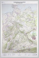
Landschaftskarte Deutschland 1 : 750 ...