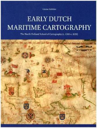
Early Dutch Maritime Cartography
6
%
4533 Kč 4 800 Kč
Sleva až 70% u třetiny knih
Foreword
I Printed Dutch Rutters and Charts for European Navigation up to c. 1585: an Overview
I.1 The Earliest Dutch Printed Rutters and Charts
I.2 The Pioneering Work of Cornelis Anthonisz.
I.3 The Leeskaartboek van Wisbuy
I.4 The Rutters of Govert Willemsz. van Hollesloot
I.5 The Cartographical Work of Adriaen Gerritsz.
I.6 Aelbert Haeyen's Amstelredamsche Zee-Caerten
II Lucas Jansz. Waghenaer: Pioneer of Dutch Maritime Cartography
II.1 Waghenaer and Enkhuizen
II.2 The First Printed Sea Atlas: The Spieghel der Zeevaerdt , 1584/85
II.3 Waghenaer's Charts of Europe, 1583 and 1592
II.4 Unknown Charts by Lucas Jansz. Waghenaer
II.5 Chart of Europe in Four Sheets, 1589
II.6 A Pilot Guide in oblong: The Thresoor der zee-vaert , 1592
II.7 Waghenaer's Enckhuyser Zee-caert-boeck , 1598
III Amsterdam: Distribution Centre of Geographical and Cartographical Knowledge
IV A Landmark in Dutch Cartography: The Wall Map of the World by Petrus Plancius, 1592
V To Farther Horizons: A Set of Printed Dutch Charts with Coastlines beyond Europe (1592-1594)
V.1 Map of the Azores, Canary Islands and Parts of the Iberian Peninsula and North-Western Africa
V.2 Map of the Atlantic Ocean with the North-Western Coasts of Africa and a Part of Brazil between 31oN and 15oS
V.3 Map of Southern Africa between 2oN and 44oS
V.4 Map of the Indonesian Archipelago and the Philippines with Surrounding Regions
V.5 Map of the Northern Atlantic Ocean
V.6 Map of the Northern Part of South America down to 35oS
V.7 Map of the Southern Part of South America and Magellanica
V.8 Map of Europe
VI Sixteenth-Century Dutch Cartography of the Mediterranean Sea
VI.1 Ascendance of the Shipping through the Strait of Gibraltar ( Straatvaart )
VI.2 Willem Barentsz. and his Nieuwe beschryvinghe ende Caertboeck vande Midlandtsche Zee , 1595
VI.3 The Overview-map of the Mediterranian Sea
VII Jan Huygen van Linschoten: Forerunner of Dutch Activities in Oversea
VII.1 Jan Huygen van Linschoten (1562-1611)
VII.2 The Publication of Van Linschoten's Itinerario , 1595/96
VII.3 The Maps in Van Linschoten's Itinerario
VII.3.1 Map of the Atlantic Ocean between 8oN and 35oS
VII.3.2 Map of the Western Indian Ocean between 8oN and 35oS
VII.3.3 Map of the Northern Indian Ocean between 0o and 43oN
VII.3.4 Map of the Indonesian Archipelago and Far East between 20oS and 40oN
VII.3.5 Map of South America and a Part of Central America with Adjacent Islands
VIII Amsterdam Publications on the Art of Navigation and Cosmography
VIII.1 Pedro de Medina and his Arte de navegar
VIII.2 William Bourne and his A Regiment for the Sea
VIII.3 Rodrigo Zamorano and his Compendio de la arte de navegar
VIII.4 Thomas Hood and his The Mariner's Guide
VIII.5 Peter Apian and his Cosmographie
VIII.6 Robert Hues and his Tractatus de globis
IX The North Holland School of Cartography (c. 1580-c. 1620)
X Cornelis Doedsz.: Caertschrijver woonende t'Edam inde Vierheems-Kinderen
X.1 Life and Work
X.2 A Chart for the Eastern and Northern Navigation, 1589
X.3 Two Manuscript Charts of Europe by Cornelis Doedsz.
X.3.1 Chart of Europe of c. 1600
X.3.2 Chart of Europe, 1607
X.4 A Commercial Chart of Europe, 1602
X.5 Willem Jansz. [Blaeu]: Publisher of Charts of Europe by Cornelis Doedsz.
X.5.1 Doedsz.'s Chart of 1605.
X.5.2 Doedsz.'s Chart of 1606
X.6 Doedsz.'s Chart of Europe, Published by Dirck Pietersz. Pers, 1610
X.7 The Graetboeck Compiled by Cornelis Doedsz.
X.8 The Atlantic Scene: The Chart of the Atlantic Ocean by Cornelis Doedsz., 1600
X.8.1 To New Horizons: Dutch Navigation to the West
X.8.2 The Chart of the Atlantic Ocean, 1600
X.9 Chart of the Western Part of the Indian Ocean, [1601-1606]
X.10 Following the Track of the Ship de Liefde: Three Dutch Charts in Tokyo
X.11 A Chart of the Indische Noord, Attributed to Cornelis Doedsz., c. 1600
XI Evert Gijsbertsz.: Caertschrijver tot Edam in die Pascaert
XI.1 A Masterpiece in Prague
| Autor: | Schilder, Günter |
| Nakladatel: | Brill |
| Rok vydání: | 2017 |
| Jazyk : | Angličtina |
| Vazba: | Hardback |
Mohlo by se vám také líbit..


